


Dean's Chapel Community Center, Jackson County, Alabama
About
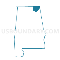
Outline

Summary
| Unique Area Identifier | 521965 |
| Name | Dean's Chapel Community Center |
| County | Jackson County |
| State | Alabama |
| Area (square miles) | 8.81 |
| Land Area (square miles) | 8.81 |
| Water Area (square miles) | 0.00 |
| % of Land Area | 100.00 |
| % of Water Area | 0.00 |
| Latitude of the Internal Point | 34.62411630 |
| Longtitude of the Internal Point | -85.82258160 |
Maps


Graphs
Select a template below for downloading or customizing gragh for Dean's Chapel Community Center, Jackson County, Alabama


Neighbors
Neighoring Voting District (by Name) Neighboring Voting District on the Map
- District Four, DeKalb County, AL
- District One, DeKalb County, AL
- Dutton City Hall, Jackson County, AL
- Pisgah Fire Hall, Jackson County, AL
Top 10 Neighboring County Subdivision (by Population) Neighboring County Subdivision on the Map
- Rainsville-Sylvania CCD, DeKalb County, AL (13,391)
- Section CCD, Jackson County, AL (7,095)
- Pisgah CCD, Jackson County, AL (4,438)
- Henagar CCD, DeKalb County, AL (3,530)
Top 10 Neighboring Place (by Population) Neighboring Place on the Map
Top 10 Neighboring Unified School District (by Population) Neighboring Unified School District on the Map
Top 10 Neighboring State Legislative District Lower Chamber (by Population) Neighboring State Legislative District Lower Chamber on the Map
Top 10 Neighboring State Legislative District Upper Chamber (by Population) Neighboring State Legislative District Upper Chamber on the Map
Top 10 Neighboring 111th Congressional District (by Population) Neighboring 111th Congressional District on the Map
Top 10 Neighboring Census Tract (by Population) Neighboring Census Tract on the Map
- Census Tract 9511, Jackson County, AL (7,095)
- Census Tract 9603, DeKalb County, AL (6,908)
- Census Tract 9510, Jackson County, AL (4,438)
- Census Tract 9602, DeKalb County, AL (3,530)